Our climb began at Paradise, a small village in Mount Rainier National Park, and it proceeded up toward the base camp, Camp Muir. While climbing the steep, snow-laden mountain slope toward Camp Muir we could see a rapidly approaching storm. As the storm struck we found ourselves climbing in a whiteout, visibility was very low, the snowfall becoming heavier, and winds significantly increasing.
Upon reaching Camp Muir we entered a “rustic”, rodent infested shelter (called the “Gombu”) which would become our home for the next two days. Just as we began unloading gear from our backpacks the storm intensified with a surprising ferocity. As we were settling down and thinking only of resting, curiosity struck – how ferocious had the storm become? We opened the shelter’s door to peer outside and were greeted with a stinging, howling blast of wind, snow, and ice pellets which roared through our wooden shack. We slammed the door shut.

Although the outhouse was a mere 20 feet beyond the shelter’s door, no one considered venturing outside for ANY reason; traveling those 20 feet seemed far too risky.


Actually, the shack’s dilapidated door, the outhouse, and the “wind tunnel” separating the two became major points of interest (for obvious reasons) as we hunkered-down with thoughts only of surviving the storm. Reaching the summit no longer seemed as enticing as it once had been; getting to the cook tent was the immediate challenge.
During Day 2 of our odyssey we remained within the shelter while attempting to stay dry and safe. Only basic needs would lead us outside and even then for only brief periods of time. For safety sake, anyone venturing outside ensured others knew of their destination and reason for leaving. As the day progressed with no relief from the storm we became aware of the extreme avalanche danger developing along our proposed route to the summit. Indeed on this morning another climbing team had aborted their summit attempt, traversed back toward our shelter and, before reaching it were caught in a slab avalanche which swept them 60 feet downhill. No one was injured and all made it back to our shelter; they were shaken and fatigued but also in good spirits.
Day 2 became one of training for crevasse rescues. Our guides set up ropes and slings within the shelter, devising various rigging systems designed for the rescue of climbers fallen into glacier crevasses. As we practiced assembling these systems I noticed the other team, those recovering from the avalanche had become very quiet. My guess is that a few were sleeping soundly and others were keenly observing us.
Now it was Day 3 and it was a beautiful, clear, sunny day. We were originally scheduled to summit in the early hours of this day. We were to climb from Camp Muir across the Cowlitz Glacier to Cathedral Gap. From there we would proceed to Ingraham Flatts and take the Ingraham Direct route to the summit. Even though the day was a beautiful one and the storm had temporarily passed, avalanche conditions continued to present dangerous risks. We aborted our summit attempt in favor of continuing on a traverse across the Cowlitz Glacier to Cathedral Gap. At Cathedral Gap we were rewarded with spectacular views of surrounding peaks, snow-capped mountain ranges, volcanoes, and blue skies.
This was a triumph over adversity. I now savor the triumph as well as the adversity and hope my future climbs will be as rewarding. Of course, good weather would be nice.
Mt Adams (view from Camp Muir)

AAI Weatherport Cook Tent

Preparing to rope-up for Cowlitz Glacier Traverse

Traversing the steep Cowlitz Glacier

Climbing team at Cathedral Gap

Little Tahoma

Mount Adams (View from Cathedral Gap)

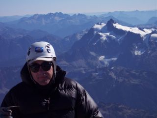
Paul at Cathedral Gap

Paul at Cathedral Gap

The Climbing Team