Saturday, June 23, 2007

Mount Ellinor

Saturday's hike on Mount Ellinor was exhilerating. After climbing the chute, a thick fog moved in, three mountain goats greeted us, one quite closely - at the summit it began lightly snowing.

Clicking on the pictures (if your computer can handle it) produces an enormous image.
THE CHUTE
Climbing The Chute
Mountain Goat (Center of Picture on Rock)
Mountain Goat 6-Feet From My Camera
Posted by Picasa

Wednesday, June 20, 2007

Lake of The Angels

Wednesday we five hiked to an overlook above Lake of the Angels; the lake was in a basin below us situated between Mt Skokomish and Mt Stone.

Trailside scenary included Mount Rainier in all of its glory, Mount Pershing which was facing us from the opposite side of the Hamma Hamma River, and multiple waterfalls. At one point we rose to a basin I will call "Three Falls Basin". As we continued to climb toward our high alpine lake destination, at one point we were surrounded by three spectacular waterfalls.

Incidentally, we met a Naval officer at the lake who, as we watched, climbed Mt Stone taking a route starting at the lake, then proceeding straight up the snow field above the lake. This looked like a fun, practical route to take at this time of year.

The pictures below were taken at overlooks along the trail and at the lake.

Clicking on the pictures (if your computer can handle it) produces an enormous image.

Trailside Waterfall

Mr Rainier and Puget Sound
Peak in front of Mt Pershing
Mt Pershing
Mt Skokomish
Mt Stone
Mt Stone (Summit not seen)
Alpine Pond

Saturday, June 16, 2007

Eagle Peak

Saturday, the usual suspects (and myself) hiked to Eagle Peak, starting at Longmire and rising 3200 feet to the western-most edge of the Tatoosh mountain range in Rainier National Park.

While others lounged on Eagle peak, one brave soul (me) ventured east to the base of a massive summit block. This could have been Chutla Peak, but the Cascade Alpine Guide calls Chutla an easy scramble, and this block was definitely a class five climb.

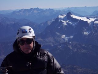
The pictures start at the Nisqually River, then using my trusty self-timing camera feature, capture all four of us working hard. This is followed by a view of our snowy ridge approach, Eagle Peak, and the massive mystery summit block east of Eagle Peak.

Clicking on the pictures (if your computer can handle it) produces an enormous image.

Nisqually River

Easily Amused People

More Easily Amused People

Snowy Ridge Approach

Eagle Peak Summit

Massive Summit Block East of Eagle Peak
Posted by Picasa

Monday, June 04, 2007

Tyler Peak & Greywolfe Ridge

Combine an unrelenting steep hike with access to an other-wordly ridge, 360 degree panoramic views, and the summit of a 6300+ foot peak, and you have the ingredients for a fine Sunday in the Buckhorn Wilderness.

My lasting impression of this hike is that of the Greywolfe Ridge. This ridge very simply has some of the most stunning, geologically interesting mountainscapes in the Olympics. I'll let the pictures tell the story. Oh...and thanks to Wade and Dave for allowing me to post a picture containing their likenesses.

If you have a relatively fast internet connection, I highly recommend clicking on each picture for a full screen view.

Volcanic Rock Formations


Magma-like Ridge Formation

A Pinnacle's View of Port Angeles

Tyler Peak Close-up

Above the Summit


Three O'Clock Ridge

High Mountain Meadow