Saturday, March 25, 2006

Mount Ellinore-Olympic Nat'l Forest (3/25/06)

Today I teamed up with eleven hikers from the Peninsula Wilderness Club to climb Mt Ellinore (5944 ft) in the Olympic National Forest.

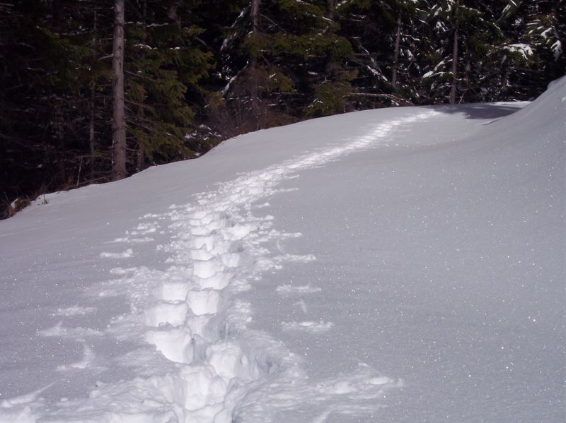
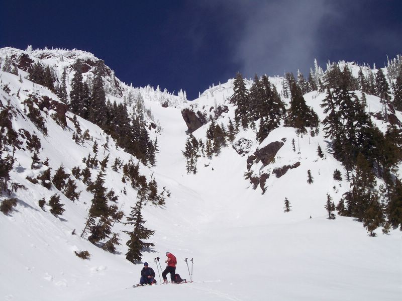
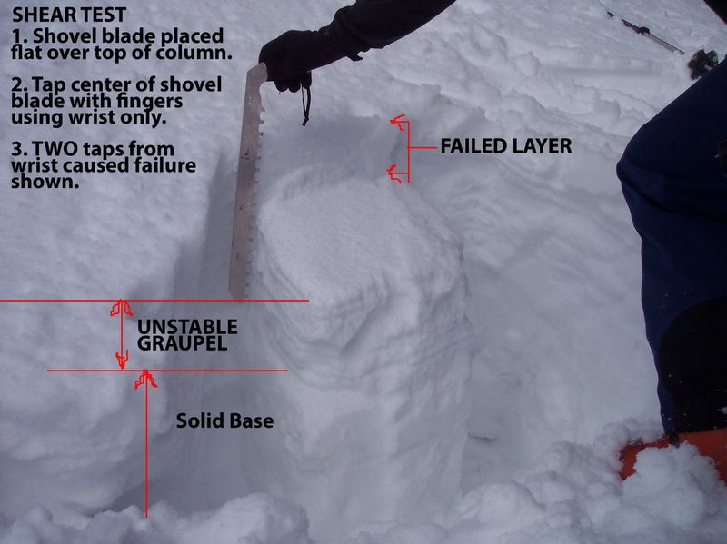
Three of our team, myself on snowshoes and two cross country skiers, climbed halfway up the chute (5650 ft), assessed the avalanche risks (see snow pit pic below), decided the risk was unacceptably high, and aborted any further attempt to climb higher.

Everyone enjoyed the fantastic sunny day and we all appreciated the rigorous workout and wonderful scenary.

Heavy snow accummulation on the road prevented us from driving up to the Lower Ellinore trailhead. This added about a 30 minute hike to the frontend of our trek. To prevent frequent, deep postholing, snowshoes or crosscountry skis were appreciated greatly by those so equipped, although everyone was able to progress to at least the bottom of the chute.

Our route from parked cars took us up the snow covered forest road, to a location 20 minutes hike beyond the lower trailhead, where we veered from the road, off to the left, up a snow bank, gaining a hogsback ridge that led to the start of the Upper trailhead. From there we mostly followed the standard Winter route to the base of Ellinor's chute (and beyond).

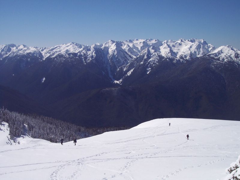
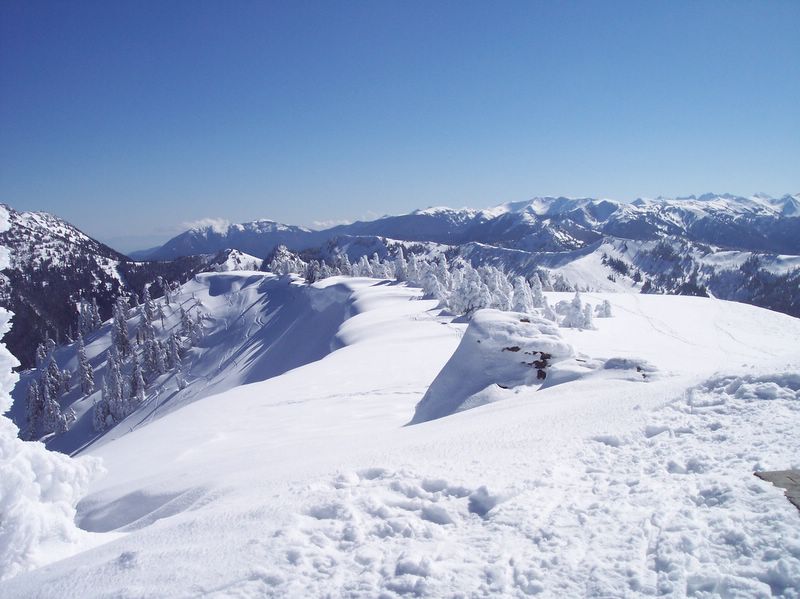
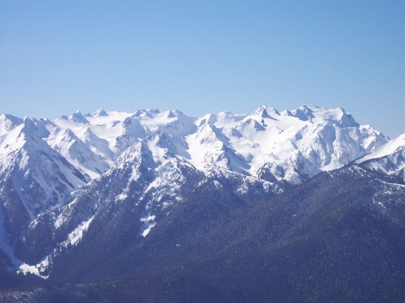
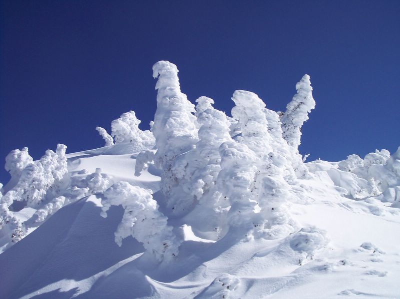
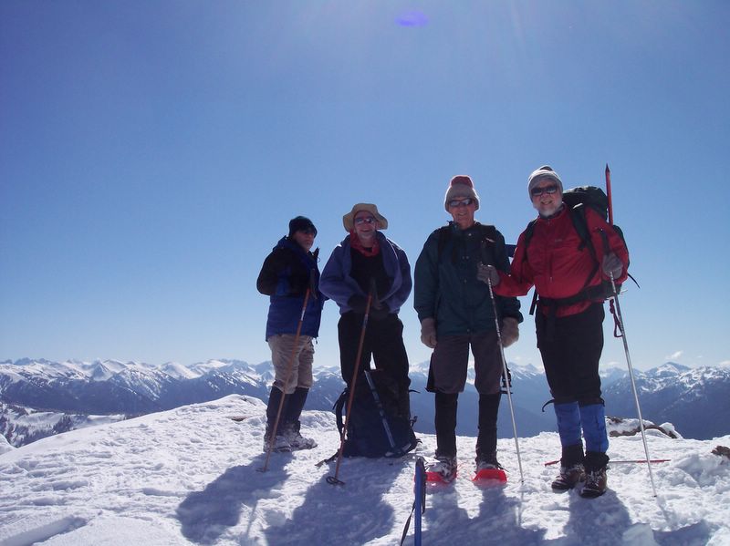
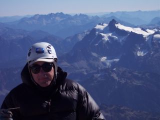
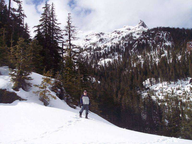
The pictures below start with views of "A" Peak (and me), taken from the upper trailhead. Following this are scenic pictures taken from various places on the Chute (the base or halfway up) and also a picture of the Chute itself.

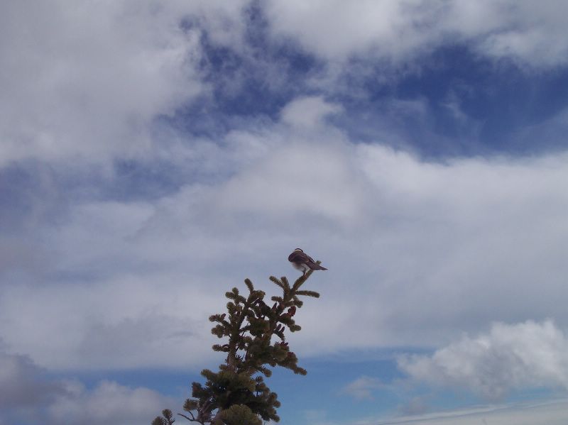
I have included a picture of the snow pit, dug by a PWC skier, that we evaluated for avalanche potential. And lastly, there is a wildlife picture of of one of our many lunchtime companions.

Note: Click picture for LARGER view.

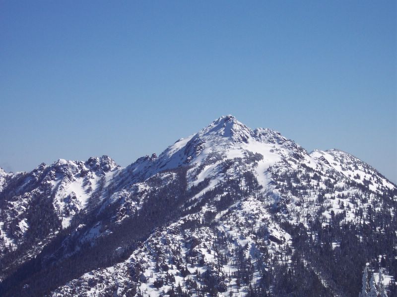
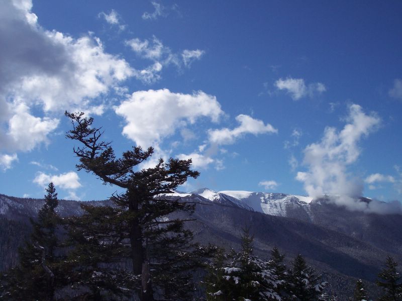
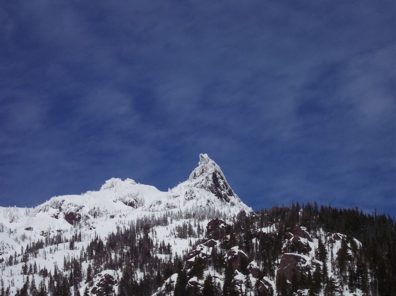
View of "A" Peak From Upper Trailhead (Paul Shown) Posted by Picasa


"A" Peak Posted by Picasa


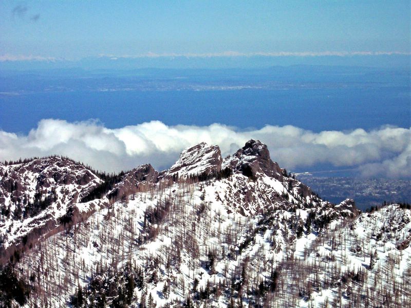
Puget Sound & Hood Canal (View from Ellinore Chute) Posted by Picasa


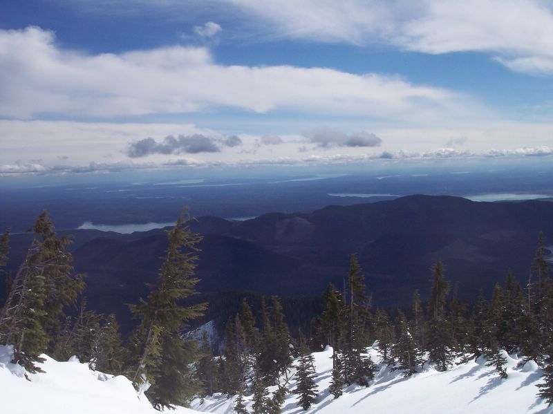
Lake Cushman (View from Ellinore Chute) Posted by Picasa


The Chute Posted by Picasa


Snow Pit Dug Halfway Up Chute Posted by Picasa


Looking Toward Top of Chute Posted by Picasa


Lunchtime Companion Posted by Picasa

Sunday, March 19, 2006

Hurricane Hill - Olympic Natl Park - 3/19/2006

Today, joined by nine other Kitsap Climbers, we snowshoed up to the summit of Hurricane Hill (5757 ft) in Olympic National Park (ONP).

Although we originally intended to climb Steeple Rock, it was so heavily corniced that, for safety sake, we reverted to plan "B" and climbed Hurricane Hill.

If you couldn't join us then you will have to trust me when I describe this as among the most beautiful, sunny days I have expierenced on the Hill.

To add to our enjoyment and our great surprise, as the overwhelming majority of our group donned snowshoes and began this trek, two of our crew jumped out ahead of the pack wearing skis and began performing ski-like acrobatics :-). I hear that Cirque du Soleil is accepting applications - our skiers would appear to be prime candidates.

The pictures below start with a view of the corniced ridge that our route paralled as it meandered up toward the steep, wide slope of Hurricane. Following this are pictures taken as we approached the summit. We were gifted with views of snow-encrusted, sculpture-like trees near the summit and another beautiful ridge. From the summit there were views of Mt Angeles, Unicorn Peak, Mt Olympus, and the Strait of Juan de Fuca.

Shown below are some of my favorite pictures taken during the trek.

Note: Click picture for LARGER view.

Corniced Ridge (center) Posted by Picasa


Climbing Hurricane Hill Posted by Picasa


Ridge With Snow Encrusted Trees Posted by Picasa


Mt Olympus Posted by Picasa


Unicorn Peak Posted by Picasa


Mt Angeles Posted by Picasa


Tree Sculptures Posted by Picasa


Tree Sculptures2 Posted by Picasa


Hurricane Hill Summit (Kitsap Climbers) Posted by Picasa


Hurricane Hill Summit (Paul) Posted by Picasa

Sunday, March 12, 2006

Deer Park

Today I snowshoed up to Deer Park along the snow covered Deer Park Road. Starting at the closed Olympic National Park (ONP) gate, I hopped over the gate and trudged to within a half mile of the ranger station in Deer Park.

It was a beautiful day for a snowshoe through this part of ONP. All together I had three deer bolt in front of me, stepped over, around, or ducked under 21 downed trees, and even took a few pictures as I gained 3100 vertical feet on this marathon 15 mile roundtrip trek.

On this solo trek I didn't see another human the entire time; I had this portion of the park completely to myself. It was an arduous, exhausting route with one lasting physical side effect - I lost 4 pounds.

Shown below are some of my favorite pictures taken during the trek.

Note: Click picture for LARGER view.

View of Ridge From Trail1 Posted by Picasa


View of Ridge From Trail2 Posted by Picasa


Deer Park Trail Snowshoe Tracks (Mine) Posted by Picasa