Friday, July 06, 2007

Camp Muir & Comet Falls/Van Trump Park

Today, climbing Mt Rainier to Camp Muir and yesterday, immersing ourselves in the thundering mists of Rainier's Comet Falls, Ron, CJ, and I celebrated Independence Days on "The Mountain".

No, there were no fire-crackers or bottle rockets, only Mount Rainier with its thundering waterfalls, awesome scenary, and critters popping up when you least expect them.

Critters? What critters? OK, we spotted fearless marmots whistling away while sunning themselves on rocks below the Muir snow field; a reddish coyote padding along in the snow; two doe each leading their own fawns to safety, and a greyish fox crossing the road.

Check out the pictures below and, if your computer can handle it, click on a picture to enjoy a full screen view.
Van Trump Creek
Comet Falls
Marmot Pleasently Basking in Sun
Annoyed Marmot Pleasently Basking in Sun

Mount Rainier
Nisqually Glacier on Mt Rainier
Mount Adams as Seen From Mt Rainier
Camp Muir
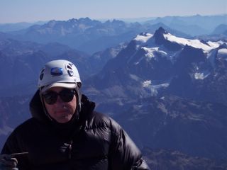
Paul (me) at Camp Muir

Saturday, June 23, 2007

Mount Ellinor

Saturday's hike on Mount Ellinor was exhilerating. After climbing the chute, a thick fog moved in, three mountain goats greeted us, one quite closely - at the summit it began lightly snowing.

Clicking on the pictures (if your computer can handle it) produces an enormous image.
THE CHUTE
Climbing The Chute
Mountain Goat (Center of Picture on Rock)
Mountain Goat 6-Feet From My Camera
Posted by Picasa

Wednesday, June 20, 2007

Lake of The Angels

Wednesday we five hiked to an overlook above Lake of the Angels; the lake was in a basin below us situated between Mt Skokomish and Mt Stone.

Trailside scenary included Mount Rainier in all of its glory, Mount Pershing which was facing us from the opposite side of the Hamma Hamma River, and multiple waterfalls. At one point we rose to a basin I will call "Three Falls Basin". As we continued to climb toward our high alpine lake destination, at one point we were surrounded by three spectacular waterfalls.

Incidentally, we met a Naval officer at the lake who, as we watched, climbed Mt Stone taking a route starting at the lake, then proceeding straight up the snow field above the lake. This looked like a fun, practical route to take at this time of year.

The pictures below were taken at overlooks along the trail and at the lake.

Clicking on the pictures (if your computer can handle it) produces an enormous image.

Trailside Waterfall

Mr Rainier and Puget Sound
Peak in front of Mt Pershing
Mt Pershing
Mt Skokomish
Mt Stone
Mt Stone (Summit not seen)
Alpine Pond

Saturday, June 16, 2007

Eagle Peak

Saturday, the usual suspects (and myself) hiked to Eagle Peak, starting at Longmire and rising 3200 feet to the western-most edge of the Tatoosh mountain range in Rainier National Park.

While others lounged on Eagle peak, one brave soul (me) ventured east to the base of a massive summit block. This could have been Chutla Peak, but the Cascade Alpine Guide calls Chutla an easy scramble, and this block was definitely a class five climb.

The pictures start at the Nisqually River, then using my trusty self-timing camera feature, capture all four of us working hard. This is followed by a view of our snowy ridge approach, Eagle Peak, and the massive mystery summit block east of Eagle Peak.

Clicking on the pictures (if your computer can handle it) produces an enormous image.

Nisqually River

Easily Amused People

More Easily Amused People

Snowy Ridge Approach

Eagle Peak Summit

Massive Summit Block East of Eagle Peak
Posted by Picasa

Monday, June 04, 2007

Tyler Peak & Greywolfe Ridge

Combine an unrelenting steep hike with access to an other-wordly ridge, 360 degree panoramic views, and the summit of a 6300+ foot peak, and you have the ingredients for a fine Sunday in the Buckhorn Wilderness.

My lasting impression of this hike is that of the Greywolfe Ridge. This ridge very simply has some of the most stunning, geologically interesting mountainscapes in the Olympics. I'll let the pictures tell the story. Oh...and thanks to Wade and Dave for allowing me to post a picture containing their likenesses.

If you have a relatively fast internet connection, I highly recommend clicking on each picture for a full screen view.

Volcanic Rock Formations


Magma-like Ridge Formation

A Pinnacle's View of Port Angeles

Tyler Peak Close-up

Above the Summit


Three O'Clock Ridge

High Mountain Meadow


Wednesday, May 30, 2007

Fin and Horn

Here is a very closeup view of these peaks. I do maintain the original pics which are stored at a higher resolution than is allowed in this blog. If you have a high speed Internet connection, click on the picture for a very large, closeup view.
Horn & Fin of Sawtooth Range

Mildred Lakes 5/30/07

Ahh yes. A middle of the week sunny day-hike to Mildred Lakes in Olympic National Forrest's Skokomish wilderness. My memories are as fond of this hike as they are of a very similar outing - you know - the Lake Constance walk-up. Fortunately I am again rewarded with every mountaineers' saving grace - a short memory.

Our crew of four started at a scenic trailhead with views of the Hamma Hamma river and its powerfully cascading water falls.

Two miles into the hike and we were progressing easily, making very good time. The flowers were beautiful, conversation interesting and jovial, and we all remarked how well the trail was maintained and flagged with red marking tape.

Suddenly, there was no conversation, the trail alternated between faint and non-existant, there were no red trail flags (at least not where they were needed), and we found ourselves scratching and clawing our way up steep, rocky, muddy drainages. Oh...did I mention we were being assaulted by blood sucking mosquitos as well? These conditions remained with us for most of our hike.

Eventually we were rewarded by simple pleasures. As we gained elevation, the mosquitos disappeared, snow began covering the tangles of roots and rocks, and route finding became less confounding.

Then we realized the real payoff. Topping out above the lakes near a cluster of boulders, while basking in the sunshine, we were rewarded with a frontal view of the entire Sawtooth mountain range. Views such as these must be earned. As you will see in pictures below, spectacular peaks in full view included Cruiser, the Fin, the Horn, and many others.

Oh, and what about the lake? Noticing the lake was mostly unfrozen, within 5 minutes we spotted six schools of trout swimming just off-shore. The lake was nice.

Please see the pictures below. If you have a relatively fast internet connection, I highly recommend clicking on each picture for a full screen view.

Hamma Hamma River


Frozen High Country Near Mildred Lake


Mildred Lake (#1)


Climbing Crew (minus Jerry G.)


Sawtooth Mountain Range


Fin and Horn Peaks Close-up


Mt Cruiser and Alpha Close-up

Thursday, May 10, 2007

Mt Townsend by North Ridge

On Thursday, 10 May, seven hikers, including myself, successfully gained the summit of Mount Townsend by the north ridge route - an adventurous and challenging climb.

As you will plainly see in the pictures below, the views are spectacular and the north ridge is very rugged. The ridge alternated from a barren expanse to a hard, icy snow crust. Half-way along the ridge, John and I soldiered ahead of the group, choosing to traverse below the ridge, around the first of two mammoth camel humps, then back up to the ridge at a saddle.

Better than describing this "interesting" traverse, see one of the pictures below - John is the tiny figure, almost imperceptible, near the small snow patch halfway down the rock. Needless to say, after climbing back up to the saddle, we shouted our recommendation to the approaching party that they avoid this traverse since it was at best iffy. Our recommendation to traverse a less steep snow ramp, avoiding the camel hump, was heeded.

This left John and I with one decision; continue over the second rocky camel hump, or join the team at the snow ramp below. John proceeded over the rocky pinnacle; I chose to climb down the steep, icy slope to join the party below - this was a decision I would soon regret.

As others had already proceeded ahead along the safer route, I became entrenched in the effort to lower myself down the hard, thin ice to their route. The run out was, well...I don't want to re-visit my memory of it. Using my ice axe to carefully cut steps on this steep slope, I proceeded slowly and cautiously, belaying with the pick-end of my ice axe. After about thirty minutes I finally gained the safer snow ramp below. To say this was exhausting (and exhilarating) is to understate the effort.

Safe and sound, we all joined up at the North summit and relaxed in the sunshine.

Please see the pictures. If you have a relatively fast internet connection, I highly recommend clicking on each picture for a full screen view.

View From North Ridge

North Ridge Route To Mt Townsend Summit

North Ridge Camel Humps Close Up

Iffy Traverse Below Ridge (See John Near Small Snow Patch)
South Summit

Paul on North Summit

Sunday, March 04, 2007

Lower Lena Lake

On Sunday, our party of five hiked to Lower Lena Lake. As we neared the trailhead, this odyssey began by spotting a herd of elk traveling up the middle of a mountain creek.

Arriving at the lake, mountain sparrows graced us with their presence, flying down from trees onto outstretched fingers.

The hike was memorable not only for the beautifully, scenic frozen lake, but there was also entertainment. Well...watching someone try to light a stove with no fuel was entertaining, but I guess you just had to be there.

Click on the picture below for larger views. The pics are all of the lake and surrounding landscape.

Creek Feeding Lena Lake (Next Three Pictures)


Hiking Along The Beach


Wildlife


Lower Lena Lake

Mountains Surrounding Lake